Sorry not available anymore though...
Here is a similar deal 0.57AC w a canal and dirt road access 5 minute drive from Florence AZ
Directions:
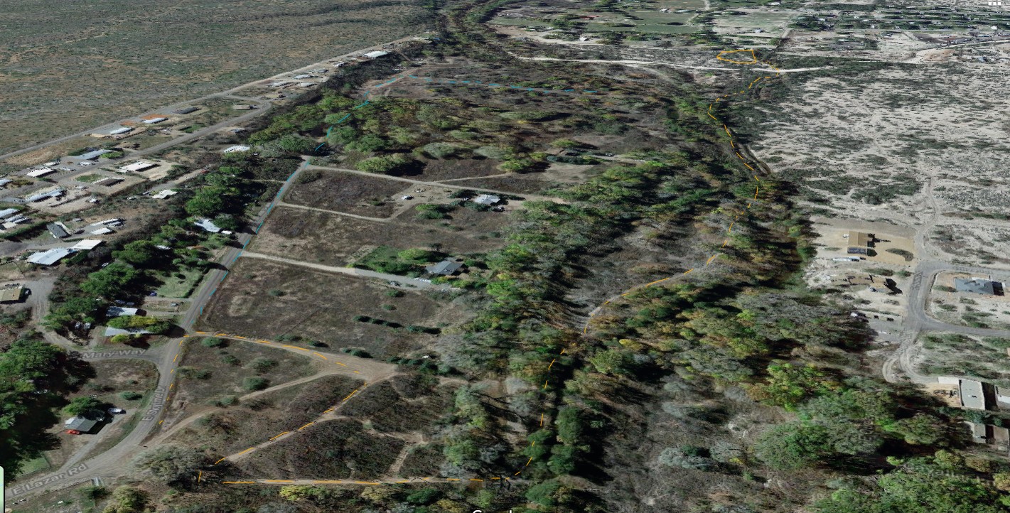
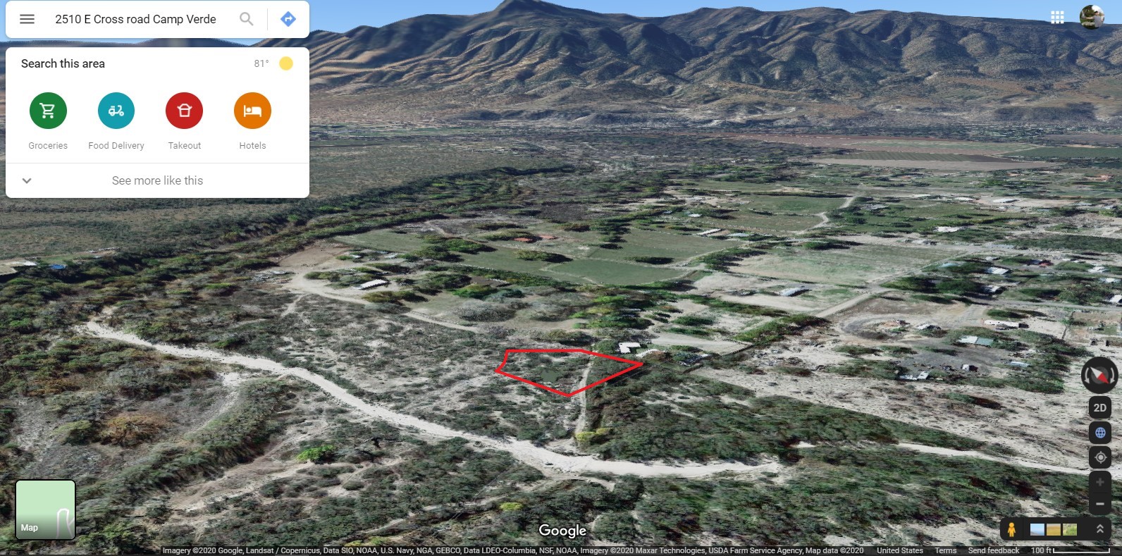
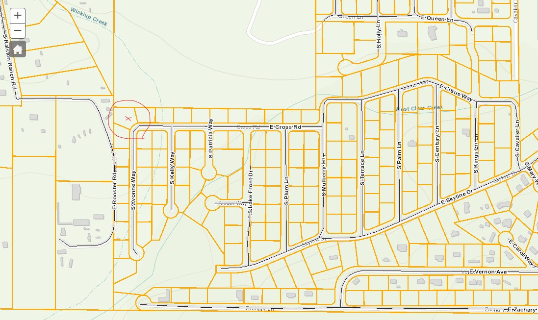
(Note I added another picture, towards the end showing the subdivision, but not all the roads in this picture may be developed.)
Recap of directions both ways
Short version of directions:
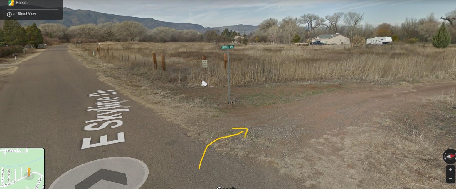
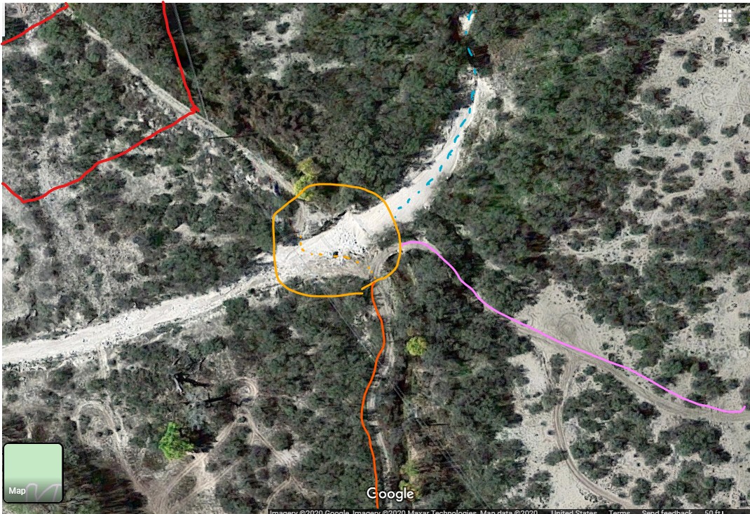
Skyline to right on Citris way: to all the way to the creek or irrigation canal and take a left on the service road that turns into Cross Road, passed the wash and your almost there, once you get to the gate that’s the end and then private property after that gate on the edge of my property.
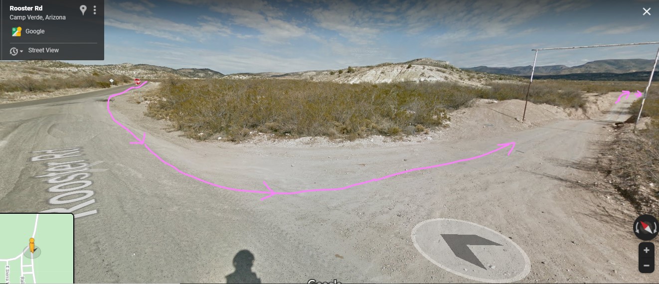
Junction begins 34.52055349900635, -111.80209310789552
This link should take you directly to this street view junction
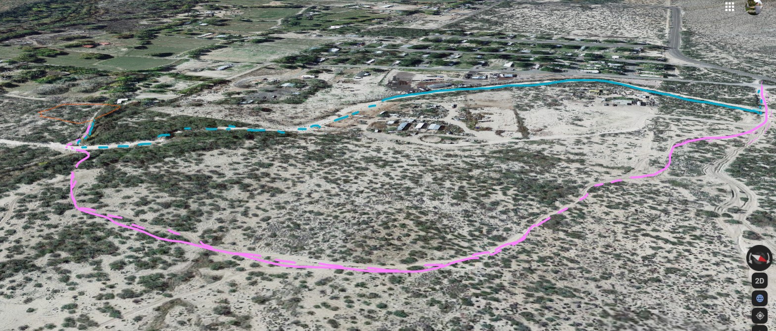
Sierra Verde Rd to Rooster Rd: just after those two roads split is a dirt rd follow that straight passed the first right which is a long drive way, then looks to me like the second right will take you all the way to the creek or irrigation canal from West Clear Creek (super crystal clear water). Cross the seasonal wash and you’re on Cross Road, the property stops at the gate. There is another dirt road across the gate but it goes through private property so don’t take rooster road all the way there, don’t worry you won’t miss their 4 giant no trespassing signs if you find yourself going that way 😊, so go either of these other 2 ways described please.
Junction begins 34.52605450930325, -111.8136088655973
This link should take you directly to this street view junction